Apr. 07, 2026
In 2020, the number of satellites launched globally exceeded 1,000 for the first time, reaching approximately 1,200-1,300 . Just six years later, the planned launch count for 2026 is a staggering 3,000-4,000 . Technologies such as rocket recovery, multiple satellite launches per rocket, and mass production have reduced the cost of launching into space to a quarter of what it was a decade ago. However , this has also led to unprecedented congestion in low Earth orbit— approximately 16,000-18,000 (mainly referring to trackable objects larger than 10 cm) , over 1 million centimeter-sized debris, and hundreds of millions of millimeter-sized debris are traversing the orbit at extremely high relative speeds.
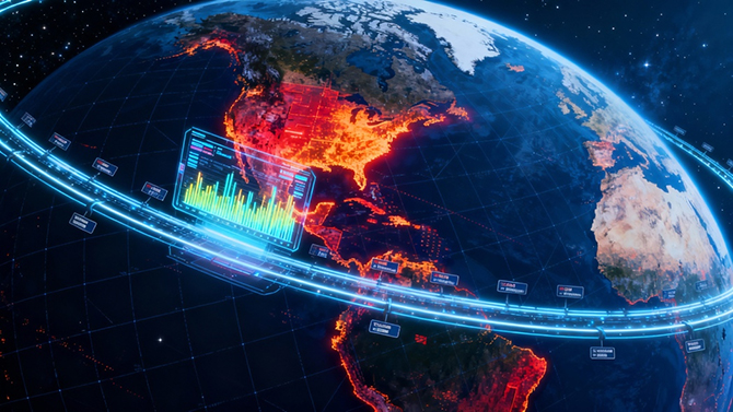
Space is no longer distant; it has become the fourth domain that humanity must properly "manage," following land, sea, and sky. As a result, Space Situational Awareness (SSA) technology, originally confined to academic research , is rapidly moving towards practical applications with the sudden acceleration of the space economy: launchers need it to plan orbital avoidance in advance, operators rely on it to effectively extend satellite lifespan, and exchanges use it to assess the "value" of orbital resources.
Next, let's open the toolkit of this "space transportation science" and see how radar, optics, space-based, and ground-based systems weave together a monitoring network that integrates space and ground, transforming previously invisible debris and risks into traceable, predictable, and tradable data coordinates.
I. What do we use to see? Two main senses: ears to hear sounds, and eyes to discern shapes.
Space exploration relies on two complementary physical "senses," much like using both ears to locate objects and eyes to identify them in the dark.
Radar: Active "Hearing", Tracking Around the Clock
Radar acts like a "sonic detector" in space, actively emitting radio waves into space and receiving the echoes reflected from targets. By calculating the round-trip time and frequency changes of the radio waves, it can accurately measure the distance, speed, and azimuth of targets. Its greatest advantage is that it is unaffected by day or night or weather conditions, and can continuously track target movements even in the dead of night or in inclement weather. However, its weakness lies in its relatively low resolution, mainly used for determining the presence of targets and basic location, and it is difficult to obtain the fine morphological features of targets .
Optics: Passive "Vision", Ultra-High Definition Imaging
Optical detection is like a space "telescope." It does not actively emit signals but only receives visible light reflected from the target or infrared radiation emitted by the target. It then reconstructs the target's outline, size, and surface features through imaging. Its resolution is far higher than that of radar, and it can clearly distinguish between satellites and debris and determine whether a structure is intact. However, its disadvantage is that it has high environmental requirements—strong light during the day causes significant interference, and clouds and haze can obstruct the view. It can usually only perform at its best on a clear night.
II . Where to Stand and Observe? Two Main Positions: Ground-based Sentinels and Space Patrols
After mastering the observation tools, it is also necessary to choose a suitable location. Ground-based and space-based "stations" each have their own advantages and disadvantages. By rationally deploying radar and optical equipment, a well-defined two-layer detection system can be constructed.
Ground-based detection: Ground-based fixed sentinels, stable and powerful.
The biggest advantage of placing radar and optical telescopes on the ground is that the equipment can be built larger and more powerful, and maintenance is convenient and relatively cost-effective. For example, large ground-based radars can provide extensive coverage of low Earth orbit, and ground-based optical telescopes can achieve high-precision orbit determination. However, its shortcomings are also obvious: due to the curvature of the Earth, there is a horizon blind zone, making it impossible to monitor targets on the other side of the Earth; at the same time, optical equipment is still subject to weather conditions, and radar detection can be affected by terrain obstructions.
Space-based detection: Space patrolmen, leaving no blind spots.
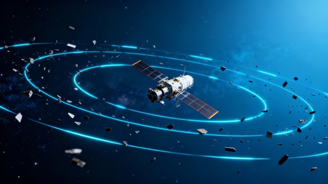
By mounting detection equipment on satellites or space stations, Earth's gravity can be broken. Space-based platforms can achieve global coverage, eliminating horizon blind spots and avoiding atmospheric interference, resulting in clearer optical imaging and more precise radar detection. For example, China's "Kainyun-1" satellite, launched in 2025, is specifically designed to track centimeter-sized debris in space, filling gaps in ground-based monitoring. However, space-based detection is also limited by satellite payload weight and launch costs, making it difficult to match the scale and power of ground-based equipment. Furthermore, repairs are extremely difficult in the event of a malfunction.
III . Interstellar Optical Remote Sensing Payload: A New Generation of "Smart Probes" for Space-Based Exploration
Currently, the new situational awareness payload under development in the field of interstellar optical remote sensing represents a significant breakthrough in space-based detection technology. With its three core capabilities—high sensitivity, large-scale active sky survey, and AI data analysis—it injects new momentum into space situational awareness.
Its high sensitivity can capture weak light signals, identify small debris that is difficult for traditional equipment to detect, low-temperature targets in the Earth's shadow, and even sense subtle changes in the target's orbit; its large-scale active sky survey capability greatly expands the observation field of a single payload, enabling it to quickly complete a panoramic scan of a specific orbital region and improve the efficiency of target detection.
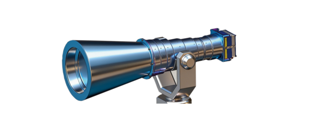
Crucially, this payload deeply integrates AI data analysis technology, essentially equipping the detection equipment with an "intelligent brain." It can autonomously complete target identification, classification, trajectory prediction, and risk assessment, breaking the time-delay limitations of traditional "data acquisition - ground analysis" and enabling real-time judgment of collision risks and abnormal target behavior.
Currently, these payloads are clearly applicable to core missions such as space target surveillance and safety early warning. They can accurately catalog on-orbit satellites and debris, and provide dynamic early warnings for satellite rendezvous and docking and on-orbit maintenance. In the future, when mounted on a space-based platform, they will further enhance the accuracy and intelligence of the integrated space-ground monitoring network, building a solid technological defense for space traffic management.

When the "ears of radar" and the "eyes of optics" open simultaneously on the ground and in space, the once dark and crowded orbits seem to light up with navigation lines: centimeter-sized debris is marked in advance, collision probabilities are pushed out in real time, and satellites can even receive "traffic jam ahead, please lift off 300 meters" alerts, much like ride-hailing services. This integrated space-ground, optoelectronic, and coordinated space situational awareness is transforming the "fourth domain" from an invisible black box of risks into a quantifiable, tradable, and manageable data highway.
The next time a rocket streaks across the night sky, please remember—above that contrail lies an invisible net woven by human wisdom, silently protecting every takeoff, every satellite, and every city on the ground, maintaining order and tranquility in the vast universe.
Quick Links
Quick Links

